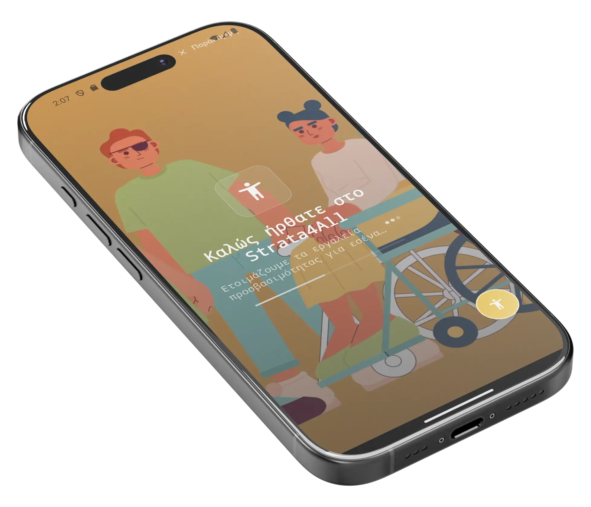
Accessible cities and festivals
Discover routes, accessibility points and live updates for people with disabilities - all in one smart app.
Smart accessibility in your pocket
With StrataforAll you find accessible routes and support points around you, with live updates. A clean, organized solution for daily commutes and events.
- Accessibility map with categories & filters
- Point cards with access indication & reviews
- Step-by-step navigation (pedestrian/bicycle/wheelchair)
- Connection to caregivers, SOS & emergency contact
- Submit photos and reports from the community


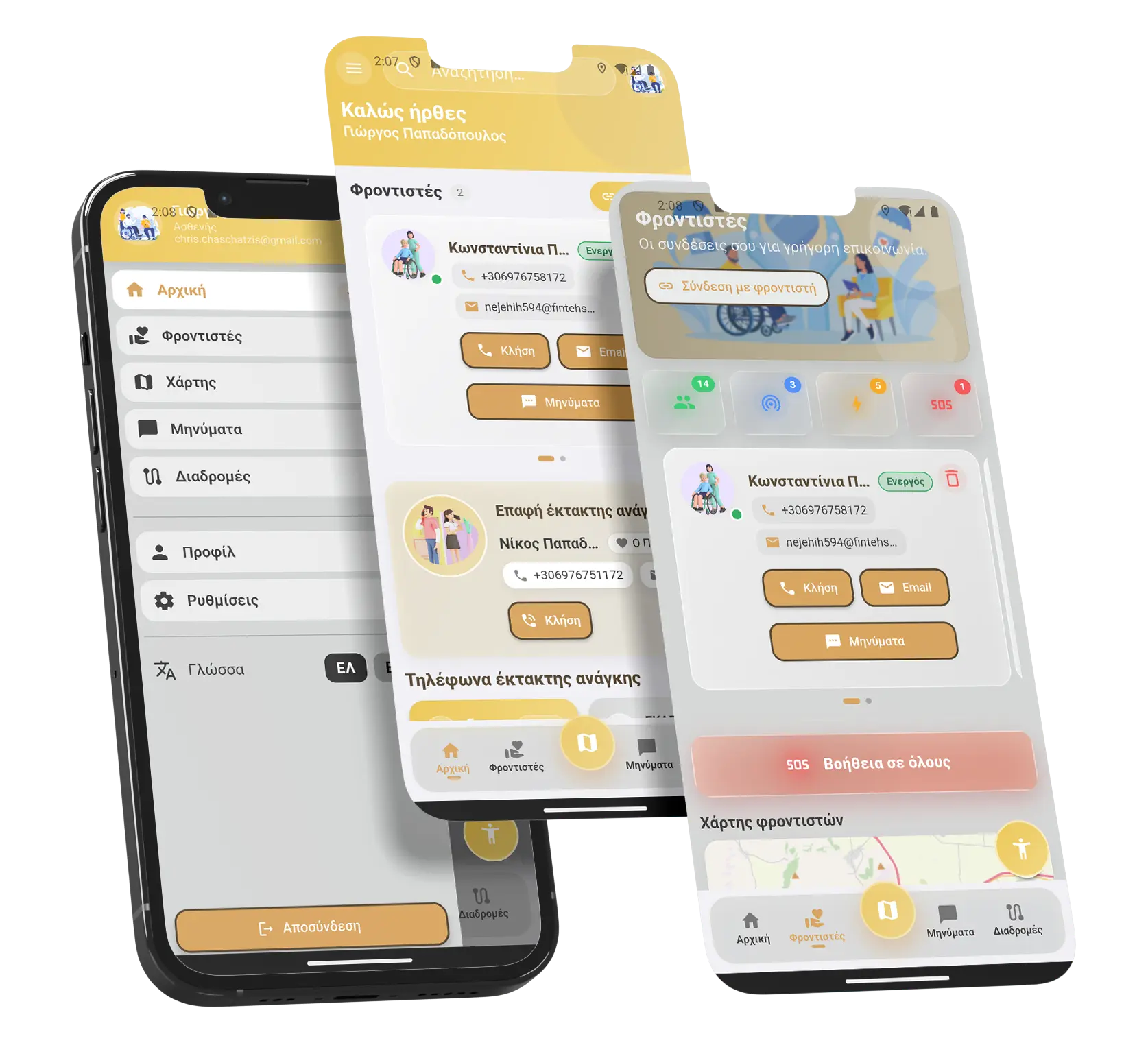
Care, connection, trust in one application.
MAP
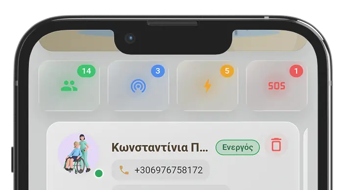
Live map of caregivers & support
With your explicit permission, you can see in real time where your carers or the people you care for are in real time.
In addition, you can send out an SOS signal in case of an emergency.
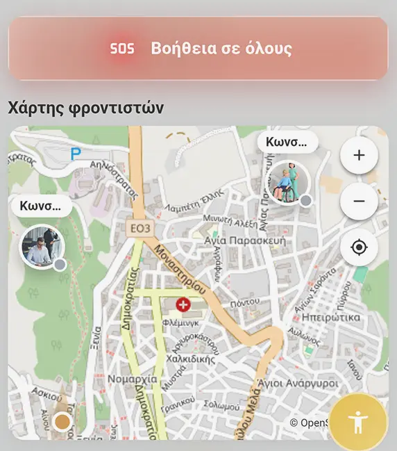
You have full control. Just a glance!
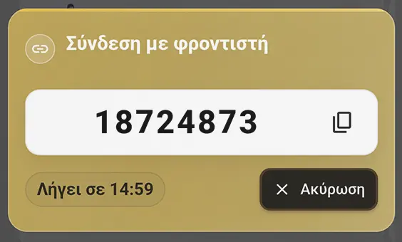
Connect to a caregiver with a one-time password
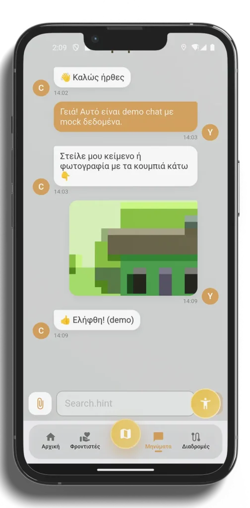
Contact
Talk to your carer, easily and safely.
Stay in touch wherever you are, with instant and simple chat through StrataforAll. Communication is encrypted and protects your personal data - without external applications.
A system that connects people, institutions and cities
StrataforAll is not just an application - it is a complete accessibility information system. Through the management panel, agencies, municipalities and regions can update and validate accessibility points transparently and reliably. The Strata for All team validates the data through local audits, creating a living, trusted accessibility map for all.
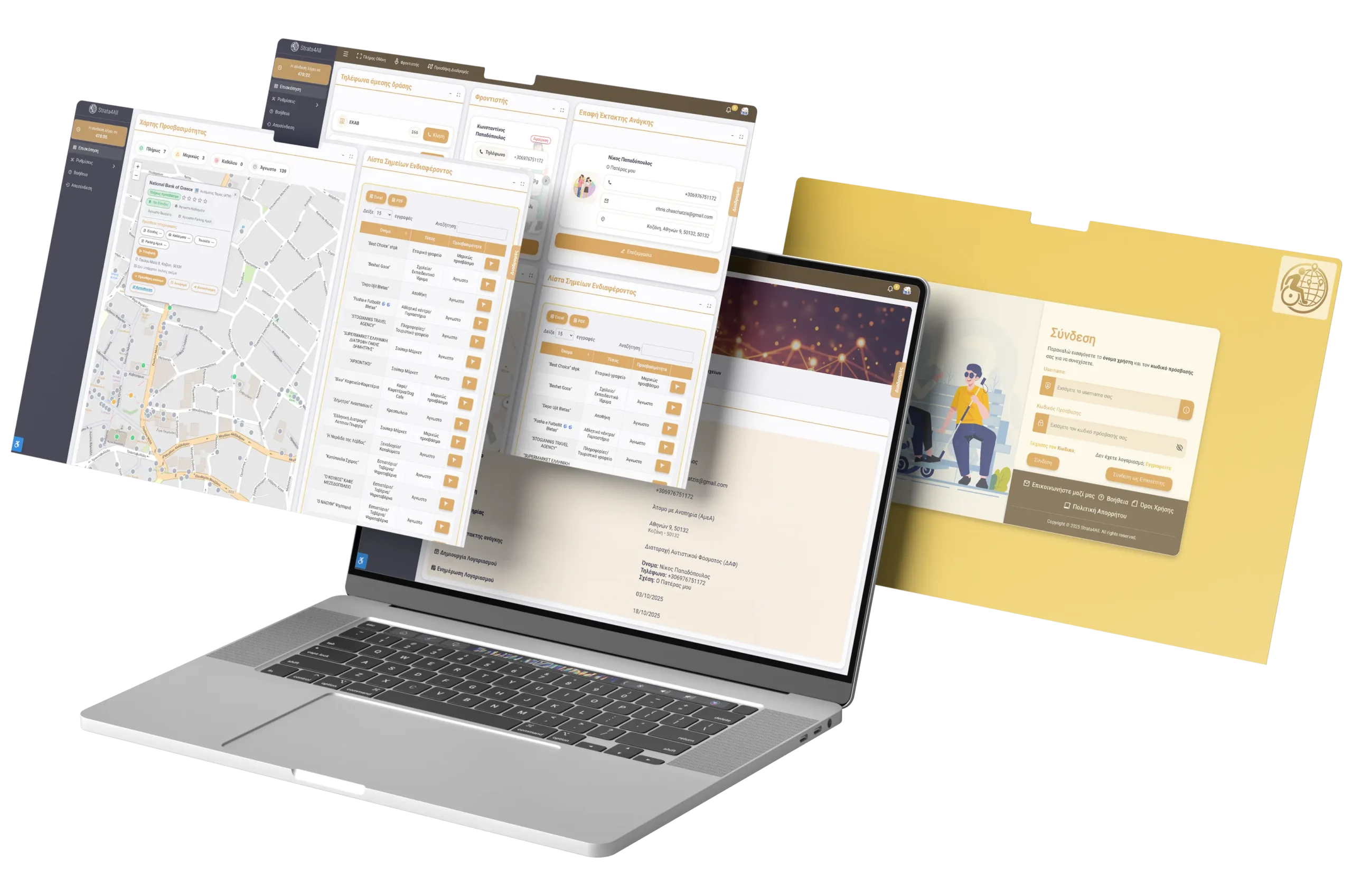
- Management panel for operators, municipalities & organisers
- Controlled submission and validation of accessibility signs
- Collaborative database involving the community, carers, agencies and volunteers.
- Built-in accessibility plugin
- Reliable data confirmed by the StrataforAll team
- Manage recent and saved routes for easy renavigation within the app
What makes StrataforAll unique
Consolidated Platform
All functions - from mapping to reporting - centralised in one system.
Real Time & Updates
Discover accessible routes and places near you - with constantly updated updates.
Dynamic Community
Users, carers and volunteers inform and confirm accessibility points.
Management for Institutions
Municipalities and regions can update, approve and certify points through a secure dashboard.
Accessibility tools
We use a special accessibility plugin in the admin dashboard, and we have also developed a separate plugin for the StrataforAll app, so that the experience remains friendly and functional for everyone, on every device.
Total Data Security
The interface is a one-time password, ensuring the privacy of each user.
Personalised experience for all
Accessible experience for all
The StrataforAll's accessibility plugin was created to tailor the user experience to the needs of each individual. It's built into the app and allows full control over how it looks, reads and moves - so everyone can navigate easily, comfortably and autonomously.
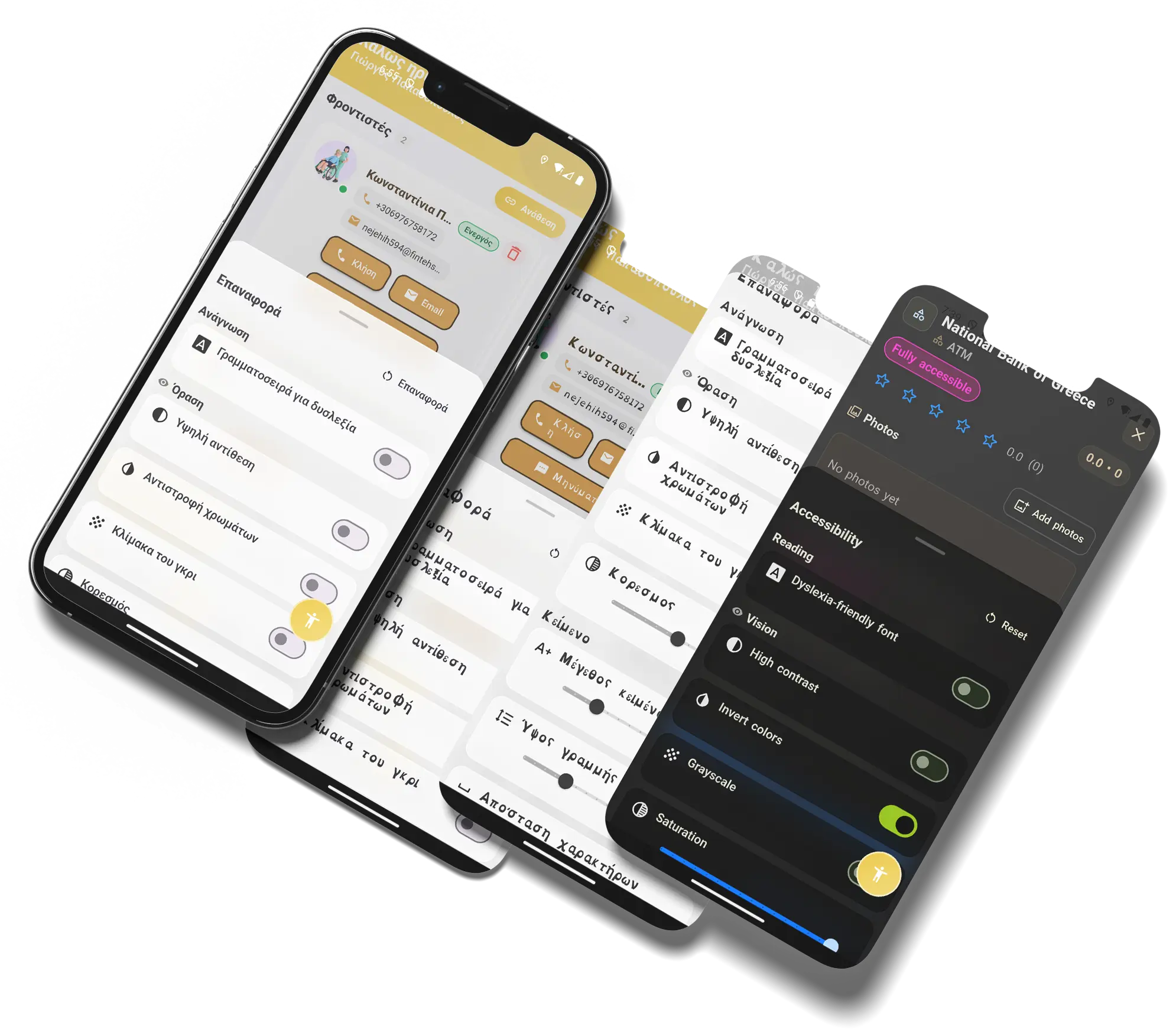
Font for dyslexia
Specially designed font that improves readability and reduces visual errors, making reading more comfortable and natural.
High contrast
It enhances the difference between background and text, providing a clearer image and easier reading.
Color reversal
It changes the colours of the screen to provide comfort for users with contrast or light sensitivity.
Scale of grey
It removes colours and displays the content in shades of grey, reducing visual fatigue and helping concentration.
Saturation
It gives the possibility to adjust the intensity of the colours, so that each user can choose the level that suits them best.
Text size
Allows dynamic change in letter size to adapt the reading to the needs of each user.
Character distance
Increases or decreases the space between letters for clearer discrimination and better visual balance.
Traffic reduction
Limits animations and effects for a more stable and smooth user experience - perfect for those who struggle with quick screen movements.
Line height
Adjusts the spacing between lines, improving reading comfort and text flow.
Word distance
It offers gap adjustment between words, making it easier to understand and reducing reading fatigue.
Language
The application supports both English and Greek, with easy switching within the plugin itself.
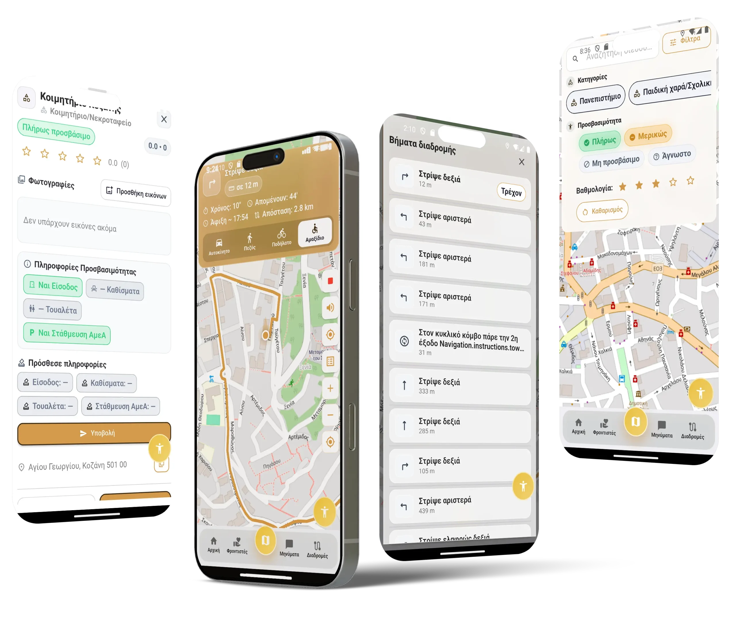
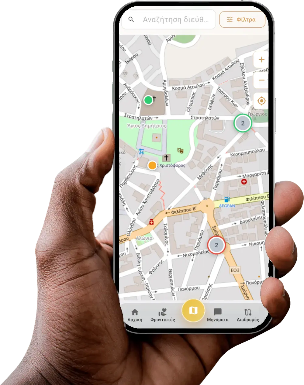
The city is becoming more accessible for everyone.
Discover points of access, support and interest with the interactive map of StrataforAll. The app offers you navigation tailored to your needs and tools that make everyday life easier, safer and more independent.
Smart search & filters
Search for places by name or category and filter the results by accessibility level - accessible, partially accessible, inaccessible or unknown. Viewing is done quickly, through a category carousel that adapts to your interests.
Places and points of interest
- Each access point opens in a dynamic tab with:
- Rating and user reviews
- Photos and accessibility status
- Address and navigation directly from the app (either via StrataforAll for accessible route, or via Google Maps)
- Ability to report on technical or accessibility issues
Wherever you go, accessibility accompanies you
StrataforAll's navigation is designed to facilitate all modes of travel - pedestrians, cyclists, drivers and wheelchair users. Offered by step-by-step guidance by voice instructions and vibration, helping you reach your destination safely and comfortably through the most accessible routes.
Community and credibility
Users, carers and volunteers can update the map data, ensuring that the information always remains accurate and up-to-date.
Be part of the change.
Help us make cities more accessible - for everyone.